In my last post, I described a little bit about the planning process for the Race of the Chasquis, and how Kristi and I went with Sergio, Tomas and Chasqui to walk the route. Sergio and Tomas were two of the organizing team, and Chasqui ran in the race. His name is really Abel, but he goes by Chasqui. He's a marathon runner. He once ran the length of the Inca road from Ecuador, the whole length of Peru, and to Bolivia, in a period of 3 months. So he's earned the right to the name of Chasqui. He helped us a lot with getting ready for the race.
Our Peace Corps entrants were my sitemate Kristi, and two other environment volunteers: Stasia and Laura. They arrived the afternoon before the race. We gathered in Chasqui's art studio to finish the racers' costumes. Chasqui painted designs on the tunics.
Each runner was required to carry a quipu, so we made them. A quipu is a message system that the Inca used by tying knots onto lengths of string of various colors. The knots could indicate time, place, number and some nouns. A quipu could carry information like "bring 60 llamas to stable 6 in Cusco in 3 weeks and we'll pay you 413 coins for them". No one knows exactly how to translate quipus anymore. We certainly don't. Our quipus probably said "two Guinea pigs April".
We started the quipus by rolling thread into thicker strings. It's easier with two people.
It's also easier if you lick your hands first.
It took quite a while, but it was fun. We were happy to get to spend time with Stasia and Laura, who live north of here, several hours away by bus. We rolled...
and rolled...
and rolled.
until we had a pile of quipu strings. Then we tied knots (two guinea pigs april?) and constructed the quipus.
We also made knee fringes for each of the runners.
Meanwhile, Chasqui kept on painting tunics.
The costumes also had to have a pututo, which is a conch shell horn. I bought the shells on vacation in Paracas, and Chasqui made the blow holes. None of us could make more than a squeal on them. Fortunately, there were no points awarded for being able to play the things. Each chasqui also had to wear a red headband (red means from Sausa) which we sewed up, and into which we stuck a feather. The costume also included a manta (brightly colored piece of cloth), a woven belt, a bag and a slingshot. After we finished everything, we went out in the street and practiced with the slingshots, throwing rocks up the dirt road. This drew quite a crowd of small children, who watched us with amazement. Chasqui and four gringas, flinging stones at nothing and laughing.
The final product was pretty impressive: three American Peace Corps volunteers, outfitted as messengers from the long-ago Inca civilization, ready to run a 5k race over a mountain in the Andes.
Saturday, June 15, 2013
Race of the Chasquis, part 1
The Inca were famous for their public works projects, one of the most impressive of which is their road system. It stretches throughout Peru, and into Ecuador, Bolivia and Chile. After 500 years, much of it is still traceable.The messengers who ran on these roads to deliver messages for the empire were called chasquis.
Our site is close to the intersection of the major north-south Inca Road, (the Capac ñan) and a transverse east-west road that runs from the coast, over the Andes through our valley, and then down to the jungle. The intersection is in Sausa, a few miles from my house. Some people in Sausa, led by Sergio, decided to organize a foot race on the 5 kilometers of the Inca road leading into Sausa. They called it the International Race of the Chasquis. To make it international, they invited Peace Corps to participate. I agreed to be the organizer, which involved a lot of emails and meetings and the job of pulling together the costumes for our runners. That was the coolest part--they ran the 5k race dressed in the traditional outfits of chasquis.
Kristi and I walked the route with several of the organizers prior to the race. The race started at the ruins of an Inca bridge. This is Sergio, the mastermind of the event, with the bridge in the background. The Inca road went steeply up over a hill from there.
We prepared for the ascent.
The Inca roads vary a lot. Some part are very overgrown.
This section was grassy with stones along the sides.
We found the ruin of a waystation where the chasquis kept supplies for their long-distance runs.
It was a misty day, and the rain was on its way. We could see it in the distance, heading toward us.
When we got to the top of the mountain, we came upon a family who were watching their animals in a high pasture. They invited us to come in under their tarps.
We shared some herbal liquer that Sergio had brought along.
By then it was raining, but we continued on. The views of the villages in the valley below were soft and lovely.
The next section of the Inca road went along the top of a ridge high above the Mantaro River,
Our site is close to the intersection of the major north-south Inca Road, (the Capac ñan) and a transverse east-west road that runs from the coast, over the Andes through our valley, and then down to the jungle. The intersection is in Sausa, a few miles from my house. Some people in Sausa, led by Sergio, decided to organize a foot race on the 5 kilometers of the Inca road leading into Sausa. They called it the International Race of the Chasquis. To make it international, they invited Peace Corps to participate. I agreed to be the organizer, which involved a lot of emails and meetings and the job of pulling together the costumes for our runners. That was the coolest part--they ran the 5k race dressed in the traditional outfits of chasquis.
Kristi and I walked the route with several of the organizers prior to the race. The race started at the ruins of an Inca bridge. This is Sergio, the mastermind of the event, with the bridge in the background. The Inca road went steeply up over a hill from there.
We prepared for the ascent.
The Inca roads vary a lot. Some part are very overgrown.
This section was grassy with stones along the sides.
We found the ruin of a waystation where the chasquis kept supplies for their long-distance runs.
It was a misty day, and the rain was on its way. We could see it in the distance, heading toward us.
When we got to the top of the mountain, we came upon a family who were watching their animals in a high pasture. They invited us to come in under their tarps.
We shared some herbal liquer that Sergio had brought along.
By then it was raining, but we continued on. The views of the villages in the valley below were soft and lovely.
The next section of the Inca road went along the top of a ridge high above the Mantaro River,
and then, finally, down into the town of Sausa where the race would end.
It was a help to know what to expect when the day of the race came and it was a pleasant hike. But I think it took a whole day before I felt really warm again, after hiking soaking wet at 12,000 feet. Ah, the Andes...
Tuesday, May 28, 2013
Went for a walk in the neighborhood this afternoon
I went for a walk, because the light was nice and I felt like messing around with my camera. This post is going to be really random. This is my street.
Here's a donkey, on my street.
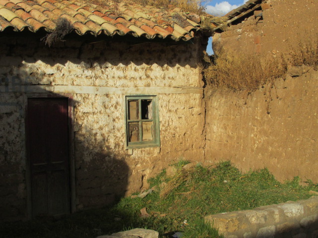
Shadow patterns on a neighbor's house.
I stopped and chatted with a friend.
Here's a typical house with its adjoining fields.
This donkey passed with a load of corn stalks
and its owner, going home at the end of the day
I walked on a path through the fields
There was a scarecrow protecting the newly harvested corn.
and more donkeys. It was a donkey kind of day
I stopped to talk with this woman who was sorting through beans in her field.
Then I headed back toward home. The shadows were growing as the sun sank.
This is a decoration on top of a house I passed.
Here's one of my students and his friend. They were playing in the street, which is perfectly safe, as the traffic is mostly donkeys and cows.
Almost home. This is the house across the street. I like its windows.

This is corn drying on the roof at our house.
Thanks for coming with me on my walk.
Here's a donkey, on my street.
Shadow patterns on a neighbor's house.
There are a lot of century plants in my district. I like them.
A view of the hill above my town, from the street next to ours.
Here's a typical house with its adjoining fields.
This donkey passed with a load of corn stalks
and its owner, going home at the end of the day
I walked on a path through the fields
and more donkeys. It was a donkey kind of day
I stopped to talk with this woman who was sorting through beans in her field.
Then I headed back toward home. The shadows were growing as the sun sank.
This is a decoration on top of a house I passed.
Here's one of my students and his friend. They were playing in the street, which is perfectly safe, as the traffic is mostly donkeys and cows.
Almost home. This is the house across the street. I like its windows.
This is corn drying on the roof at our house.
Thanks for coming with me on my walk.
Monday, May 20, 2013
Early In-Service Training
I am woefully behind on blog posts. Many apologies to the families who read my blog, including Kristi's family, Brian's family, and of course, my own family. It's been a whirlwind period of time. I'm going to go back now and fill in some of the events of the past months. Let's start with EIST.
In March, everyone in the Environment (MAC) program from our year--that's 14 of us--gathered for more training. The first part of training was in Chosica. Each of us brought a community member to the training, which was on how to design a project and develop a budget for it.
I brought Chasqui and Kristi brought Mily. It was very good training, but it was a lot of information in a few long days. It was great to see our training class, though. It seems like everyone is thriving in their sites. It was interesting to meet other volunteers' work partners, too.
Peace Corps tries to make training as useful as possible. We worked on an actual project and got individual feedback from the trainers. Here we are with Luis, talking about how to frame goals for our ecotourism initiative.
Afterward, everyone got certificates of participation.
...
After that, our community partners left and MAC Peru 20 received more training and went through the ordeal of presenting our community diagnostics. It was kind of weird to be back in the training center, hearing about safety and medical and how to deal with assessment documents. Being in site is way better than training. It is nice to see how far we've come since training, in just a few months. I was pleased to hear compliments from the director of Spanish language training on how much my language skills have improved.
One of the requirements of PC volunteers is to investigate our community and present a diagnostic report on the situation in the community and its ideas for projects we can work on together. One technique we use is to have people make maps of the community. Back in February, while I was teaching English in summer school, I had my secondary students draw a map of Marco. It included places that are important, well liked, and those that have environmental problems. This was the moment that I first learned that one of the sources of water contamination is people throwing their dead animals in the river. The boys and the girls did their maps separately.
I bet you can guess which was whose.
..
Yep, you were right:
My diagnostic included lots more information, from interviews, documents from government offices, and lots of personal observations. It was a good presentation, and I was really glad when it was OVER.
We had some field training also. We went up into the mountains a ways to plant more trees in a location a previous volunteer had started.It was a pretty place.
I planted some trees. I hope they grow.
The best part was working together with some of my favorite people.
In March, everyone in the Environment (MAC) program from our year--that's 14 of us--gathered for more training. The first part of training was in Chosica. Each of us brought a community member to the training, which was on how to design a project and develop a budget for it.
I brought Chasqui and Kristi brought Mily. It was very good training, but it was a lot of information in a few long days. It was great to see our training class, though. It seems like everyone is thriving in their sites. It was interesting to meet other volunteers' work partners, too.
Peace Corps tries to make training as useful as possible. We worked on an actual project and got individual feedback from the trainers. Here we are with Luis, talking about how to frame goals for our ecotourism initiative.
Afterward, everyone got certificates of participation.
...
After that, our community partners left and MAC Peru 20 received more training and went through the ordeal of presenting our community diagnostics. It was kind of weird to be back in the training center, hearing about safety and medical and how to deal with assessment documents. Being in site is way better than training. It is nice to see how far we've come since training, in just a few months. I was pleased to hear compliments from the director of Spanish language training on how much my language skills have improved.
I bet you can guess which was whose.
..
My diagnostic included lots more information, from interviews, documents from government offices, and lots of personal observations. It was a good presentation, and I was really glad when it was OVER.
We had some field training also. We went up into the mountains a ways to plant more trees in a location a previous volunteer had started.It was a pretty place.
I planted some trees. I hope they grow.
The best part was working together with some of my favorite people.
Subscribe to:
Posts (Atom)